Quick Facts
- Network Dominance: Dedicated satellite messengers using the Iridium network (like Garmin) offer true global coverage and faster transmission speeds compared to the Globalstar network used by iPhones, which often requires manual aiming and a clear sky view.
- The Rescue Gap: Triggering an SOS is near-instantaneous, but actual Search and Rescue (SAR) response times vary wildly—from two hours to two weeks—depending on terrain, weather, and local jurisdiction.
- Battery Realities: The advertised 25-day battery life on the Garmin inReach Messenger Plus is only achievable in low-power mode; active tracking and continuous monitoring will drain the unit in about 5 days.
- Starlink’s Hidden Cost: While revolutionary for speed, a mobile Starlink Mini setup adds approximately 17 pounds to your pack once you factor in the power station and solar panels.
Introduction: The False Sense of Security in the Backcountry
We’ve all been there. You’re standing on a ridgeline, the wind is howling, and the trail has effectively vanished into a scree slope. You reach down, feel the rugged plastic of your satellite messenger, and a wave of relief washes over you. It’s the "security blanket" effect. In the modern era of outdoor exploration, we’ve come to view these devices as magic "get out of jail free" cards. If things go south, we just press the button and a helicopter appears, right?
Not exactly.
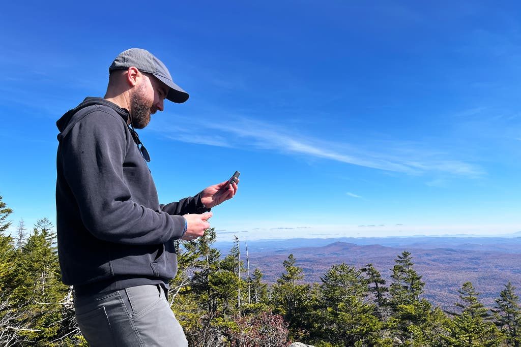
After years of solo expeditions across the Brooks Range and the high deserts of Utah, I’ve learned that satellite messaging reliability is often misunderstood by the very people who rely on it most. Having a signal does not guarantee a rescue, and having a device does not mean you are "connected." There is a massive technical and logistical chasm between sending a text and being saved. Whether you are weighing the Garmin inReach vs iPhone satellite capabilities or considering hauling a Starlink into the brush, you need to understand the physics and the politics behind the screen.
1. Network Physics: Why Iridium Beats Globalstar and iPhone
When we talk about reliability, we are really talking about the satellites orbiting 500 to 1,000 miles above your head. Not all satellite networks are created equal. The two major players in the handheld space are Iridium and Globalstar.
The Iridium Network is the gold standard for a reason. It consists of 66 cross-linked Low Earth Orbit (LEO) satellites. Because they talk to each other, a message can "hop" across the sky until it finds a ground station. This creates a true polar-to-polar global web. If you are in a deep canyon in Antarctica or a rainforest in the Congo, an Iridium device like the Garmin inReach Messenger Plus is going to find a window to the sky eventually.
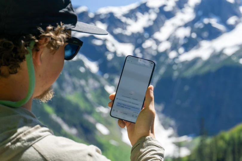
The Globalstar Network, which powers the iPhone’s emergency features and SPOT devices, operates differently. It relies on a "bent-pipe" architecture, meaning the satellite must see both you and a ground station simultaneously to transmit. This is why iPhone users are often prompted to "aim" their phone at a specific point in the sky. In a life-or-death scenario where you might be injured, pinned, or losing consciousness, the requirement for precise manual aiming is a significant failure point.
| Feature | Iridium (Garmin, ZOLEO) | Globalstar (iPhone, SPOT) |
|---|---|---|
| Coverage | True Global (Pole to Pole) | Regional (Gap in mid-oceans/poles) |
| Transmission | Two-way, High Reliability | Variable, requires "View of Sky" |
| Antenna Size | Large, External, Omnidirectional | Internal, Small, Directional |
| Best For | High-risk, remote expeditions | Day trips, near-fringe areas |
In my testing, I’ve found that the iPhone satellite messaging service is a fantastic "Plan B" for a day hike in Yosemite or a weekend in the Catskills. But for the best satellite communicator for wilderness survival, the dedicated hardware wins because its antenna is designed for one job: punching a signal through a canopy of pine needles.
2. The 'SOS vs. SAR' Gap: Minutes vs. Weeks
This is the hardest pill for most adventurers to swallow: The "SOS" button is a notification, not a command.
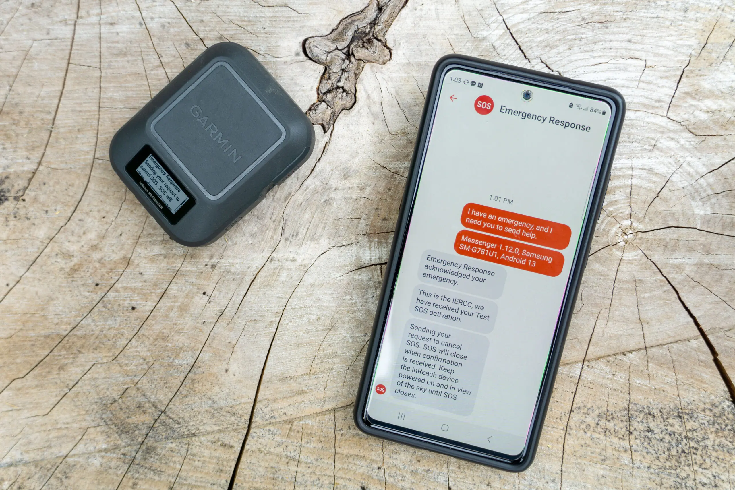
When you trigger an SOS on a Garmin device, the signal hits the Iridium network, travels to a Garmin Response (formerly GEOS) center in Texas, and an emergency dispatcher begins the process of calling local authorities. This part of the chain is incredibly fast—usually taking only minutes.
However, the transition from Dispatch to Search and Rescue (SAR) is where the "reliability" of your rescue starts to fluctuate.
Warning: The Reality of Rescue Do not assume that an SOS signal equals an immediate flight. SAR teams are often composed of volunteers. If you trigger an alert at 11:00 PM during a whiteout blizzard in the North Cascades, no one is coming until the weather clears. In some international territories with limited resources or political instability, a response can literally take weeks—if it comes at all.
Factors that delay your rescue:
- Terrain Density: If you are at the bottom of a slot canyon, your device may struggle to maintain a GPS lock, meaning dispatchers know you're in trouble but don't know exactly where you are.
- Local Resources: In the US, we are spoiled with highly trained SAR units. In remote parts of Kyrgyzstan or even parts of the Andes, the "local SAR" might just be a local police officer with a truck and no mountain training.
- Weather: Helicopters have strict "no-fly" parameters. If the wind is above 40 knots or visibility is zero, you are on your own until the front passes.
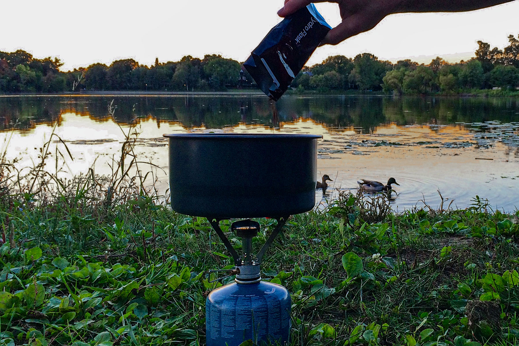
3. Battery Life Realities: The 25-Day Myth
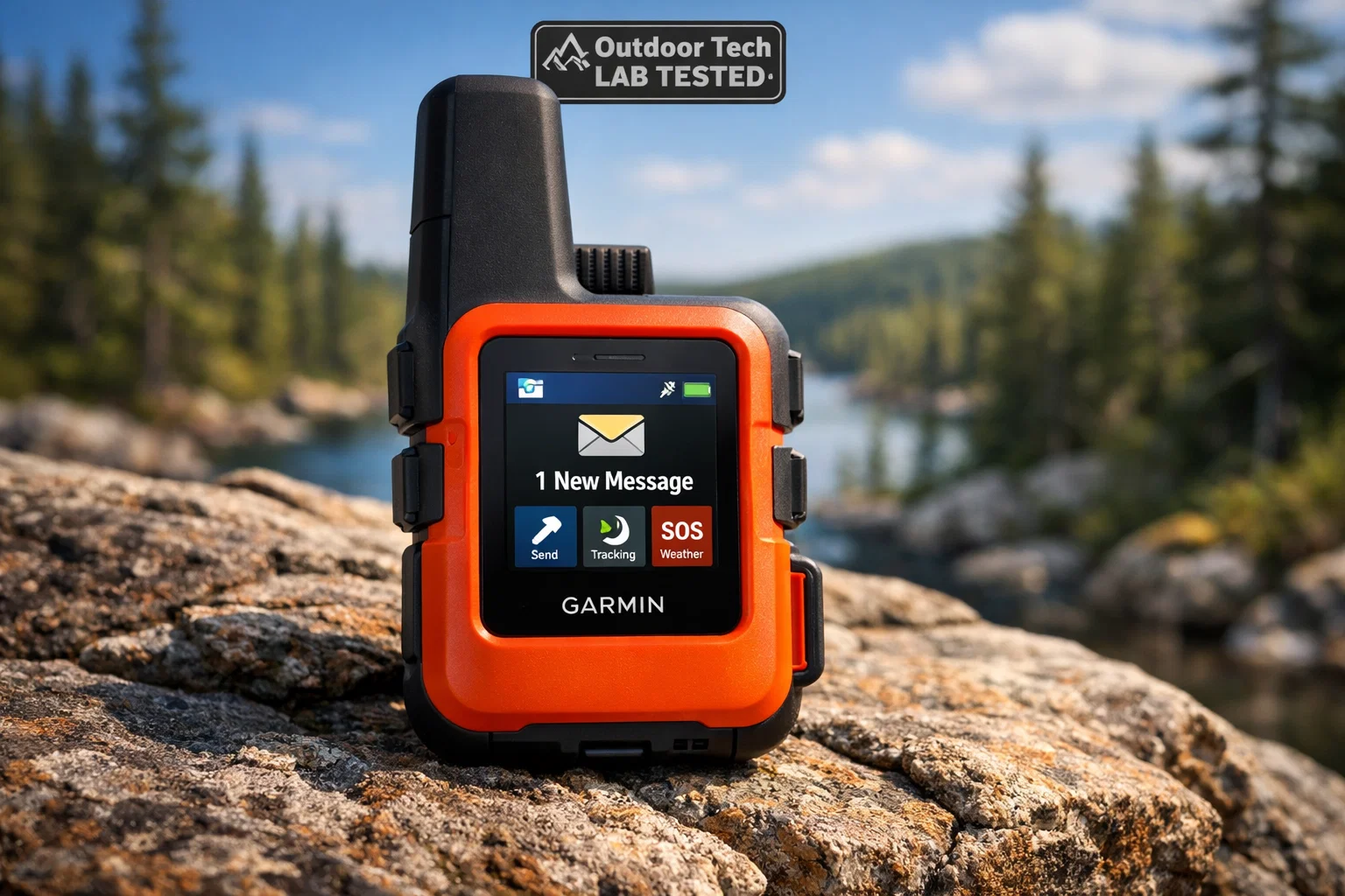
Marketing teams love the number "25." Specifically, the claim that the Garmin inReach Messenger Plus can last up to 25 days on a single charge. While technically true, this comes with a massive asterisk that could leave you with a dead brick in your pocket if you aren't careful.
To achieve that 25-day battery life, you have to enable a low-power mode that essentially puts the device to sleep. It might only check for incoming messages once every 30 or 60 minutes. If your family is trying to reach you with urgent weather updates, you won't see them for an hour.
If you want the device to function the way most people expect—with continuous message monitoring and 10-minute tracking intervals so your friends can see your progress on a map—the battery life drops off a cliff. In my field tests, continuous message monitoring drains the battery in approximately 5 days.
The iPhone is even more fragile. While the SOS feature is integrated, using a phone as a primary backcountry tool is a recipe for disaster. Between the cold weather killing the lithium-ion cells and the high power draw of searching for a satellite signal, an iPhone without an external battery pack is effectively a one-day device.
For anything longer than a weekend, you need a power strategy:
- Garmin/ZOLEO: Keep it in "Extended Tracking" mode.
- External Power: Carry a minimum 10,000mAh PD (Power Delivery) bank.
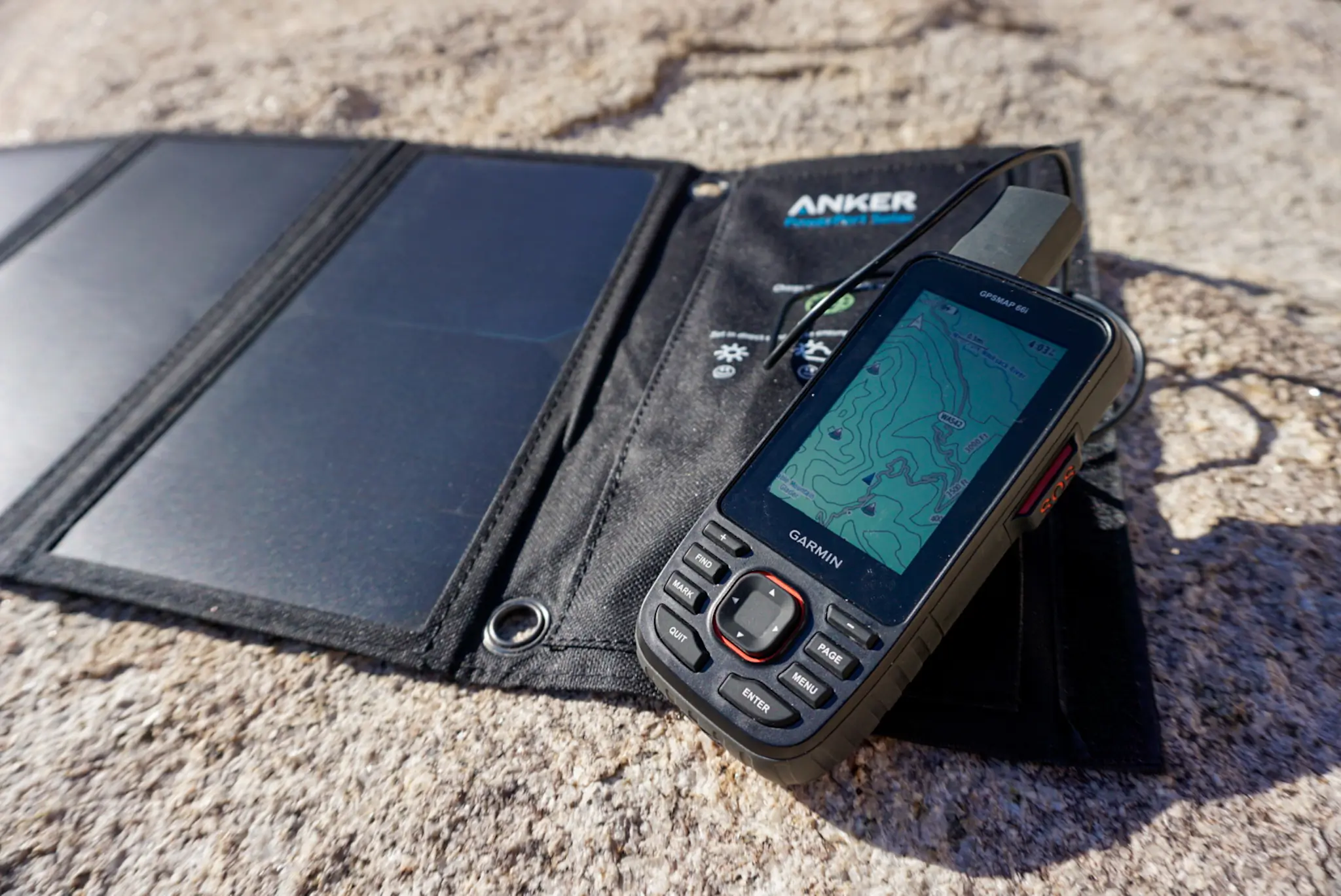
- Solar: If you're out for more than 10 days, a 5W to 10W panel is a non-negotiable insurance policy.
4. Starlink Mini: High Speed, Heavy Burden
The latest buzz in the backcountry is the Starlink Mini. The idea of having 100Mbps download speeds while sitting next to an alpine lake is seductive. I’ve used it, and yes, it feels like magic. But when we talk about satellite messaging reliability for the backpacker, Starlink is a different beast entirely.
The Starlink Mini unit itself is impressively small, but it is not a "pocket" device. To have a functional, reliable off-grid setup, you aren't just carrying the panel. You are carrying an ecosystem.
The 17-Pound Reality Breakdown:
- Starlink Mini Panel: ~2.5 lbs
- Portable Power Station (e.g., Jackery 300): ~7 lbs (Necessary to keep the dish running for more than an hour or two).
- Solar Panel (to recharge the station): ~6 lbs
- Cables and Mounting: ~1.5 lbs
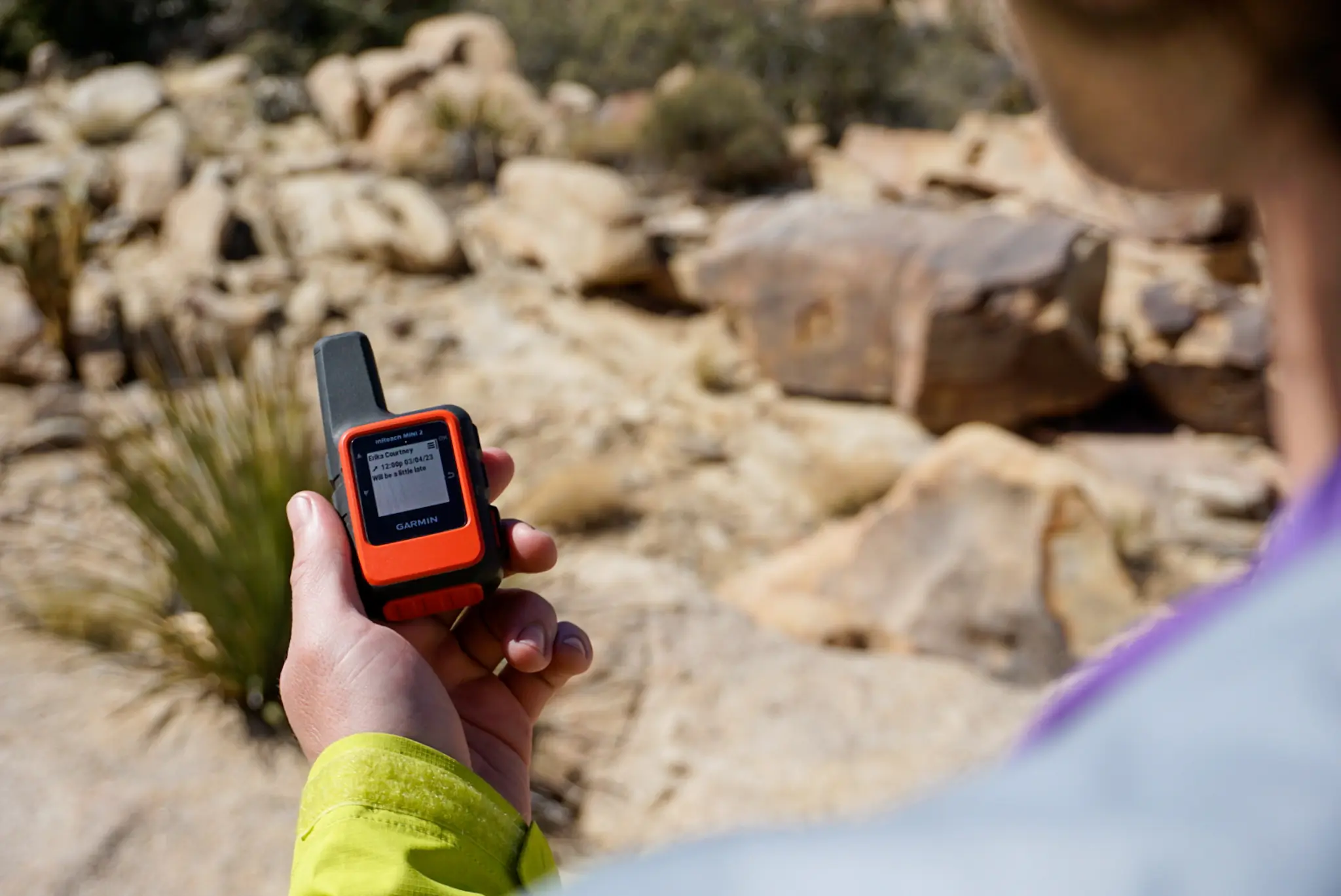
At roughly 17 pounds of additional gear, Starlink is 20 times heavier than a standard pocket messenger like the inReach Mini 2 (3.5 oz). Furthermore, Starlink is not a "tracking" device. You cannot leave it on in your backpack while you hike to let people know where you are. It requires a stationary setup and a massive clear view of the northern sky. It is a tool for basecamp communication and digital nomads, not a lifeline for a solo trekker moving through technical terrain.
5. Choosing Your Lifeline: Match Your Device to Your Risk
Reliability is subjective. If your idea of "outdoors" is a well-marked trail within 20 miles of a major city, your needs are vastly different from someone crossing the Gates of the Arctic.
For the Weekend Warrior (Day Trips & Overnight Stays)
If you are sticking to North America (US, Canada, Mexico) and staying on established trails, the iPhone satellite messaging is actually a solid choice. It saves you the $15-$30 monthly subscription fee of a Garmin. Just ensure you carry a small battery bank. It's "good enough" for the 90%.
For the Serious Adventurer (High-Risk & Multi-Day)
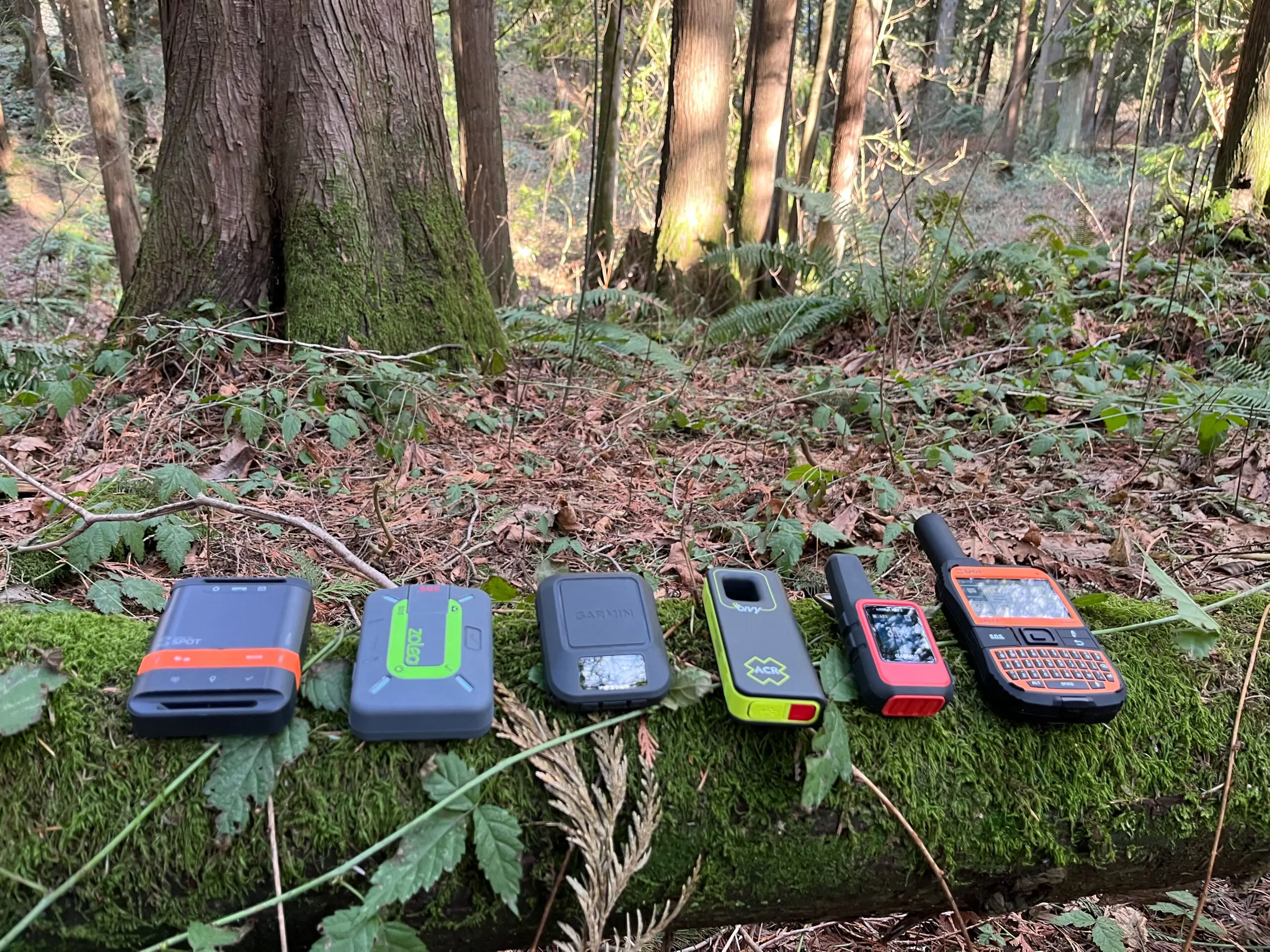
The Garmin inReach Messenger Plus remains the gold standard. Its ability to send photos and voice notes over satellite is a game-changer for describing a medical injury to a doctor, but its true value is the Iridium network coverage and ruggedized build. You can drop it in a stream, bounce it off a rock, and it will still send that SOS.
For the Group Communicator
The ZOLEO Satellite Communicator is my top pick for those who want a seamless messaging experience. It switches between Wi-Fi, Cellular, and Satellite automatically, so you don't waste satellite pings when you have a bar of LTE. However, it relies heavily on your smartphone's screen, whereas a Garmin has a standalone interface.
Check out the Garmin inReach Messenger Plus →
No matter what you choose, remember that the most reliable tool in the backcountry isn't the one in your pocket—it's the one between your ears. No satellite messenger can replace good judgment, navigation skills, and a solid "Leave No Trace" plan.
FAQ
Does the iPhone satellite feature work under trees? Rarely. The Globalstar signal used by iPhones is significantly weakened by dense leaf cover or heavy rain. You typically need a clear, unobstructed path to the sky to send a message.
Which satellite messenger has the best coverage in the Grand Canyon? Because of the deep, narrow walls, devices using the Iridium network (Garmin, ZOLEO) perform better. They have more satellites in the sky at any given time, increasing the "window of opportunity" for a signal to escape the canyon walls.
Can I use Starlink Mini while I am hiking? No. The Starlink Mini is designed for stationary use. It requires a steady orientation and draws too much power to be used as a mobile tracking device in a backpack.
Stay Safe Out There
The wilderness doesn't care about your subscription plan. Test your gear before you leave the trailhead, tell someone your itinerary, and never rely on a battery for your survival. If you found this guide helpful, check out our other deep-dives into backcountry safety and solo expedition gear.