Quick Facts
- The Discovery: New 2025 survey data reveals that East Crestone is exactly 3.6 inches (0.3 feet) taller than the historically recognized Crestone Peak.
- The Ranking Shift: Under standard mountaineering rules, East Crestone becomes the official "ranked" summit, while Crestone Peak is demoted to a sub-peak.
- The Methodology: Researchers used Trimble DA2 dGNSS receivers, logging simultaneous data for 135 minutes on both summits to achieve sub-inch accuracy.
- The 300-Foot Rule: Because the saddle between the two peaks is only about 50 feet deep, only one can be considered an official "ranked" 14er.
- The Verdict: Peakbaggers aiming for the "official" Colorado 14er list must now ensure they reach the summit of East Crestone.
The 3.6-Inch Shocker: Why Colorado’s 14er List Just Changed
For decades, the Colorado mountaineering community has operated under a stable, if occasionally debated, list of 58 peaks exceeding 14,000 feet. However, geography is rarely as static as our maps suggest. In a revelation that has sent shockwaves through the peakbagging community, new 2025 survey data has confirmed a monumental shift in the Sangre de Cristo Range. East Crestone is now officially taller than its neighbor, the legendary Crestone Peak.
The findings, spearheaded by mountain surveyor Eric Gilbertson, indicate that East Crestone sits at a higher elevation than the point hikers have traditionally called the summit. Is East Crestone a new Colorado 14er? Technically, yes—it is the new "ranked" summit of the mass. According to the 2025 dGNSS survey, East Crestone is 3.6 inches taller than Crestone Peak. This tiny margin is enough to trigger a major administrative change: East Crestone takes the crown as the ranked peak, while the historically famous Crestone Peak is relegated to the status of a secondary summit.
This isn't merely a matter of academic curiosity. For those seeking to complete the "Official 58," the target has moved. While many hikers naturally traverse between the two due to their proximity, those who only touched the traditional Crestone Peak cairn can no longer claim to have stood on the highest point of the massif.
The Science of the Swap: How 3.6 Inches Were Measured
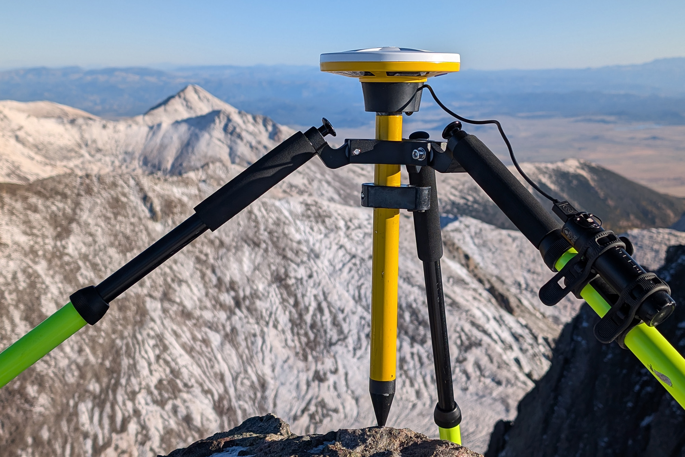
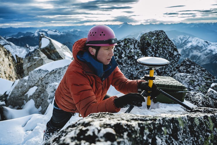
In the past, mountain elevations were determined by localized leveling or, more recently, by 2020 LiDAR (Light Detection and Ranging) data. While LiDAR is excellent for mapping large swaths of terrain, it has a notorious weakness: "spikes." A bird, a stray rock, or a dense patch of snow can cause a LiDAR return to register a false high point. To settle the debate between the two Crestone summits once and for all, a team led by Eric Gilbertson employed a much more rigorous method in October 2025.
The team utilized Trimble DA2 dGNSS (Differential Global Navigation Satellite System) receivers. Unlike a standard handheld GPS, which might be accurate to ten feet, these high-precision instruments communicate with multiple satellite constellations and correction networks to achieve precision down to the centimeter.
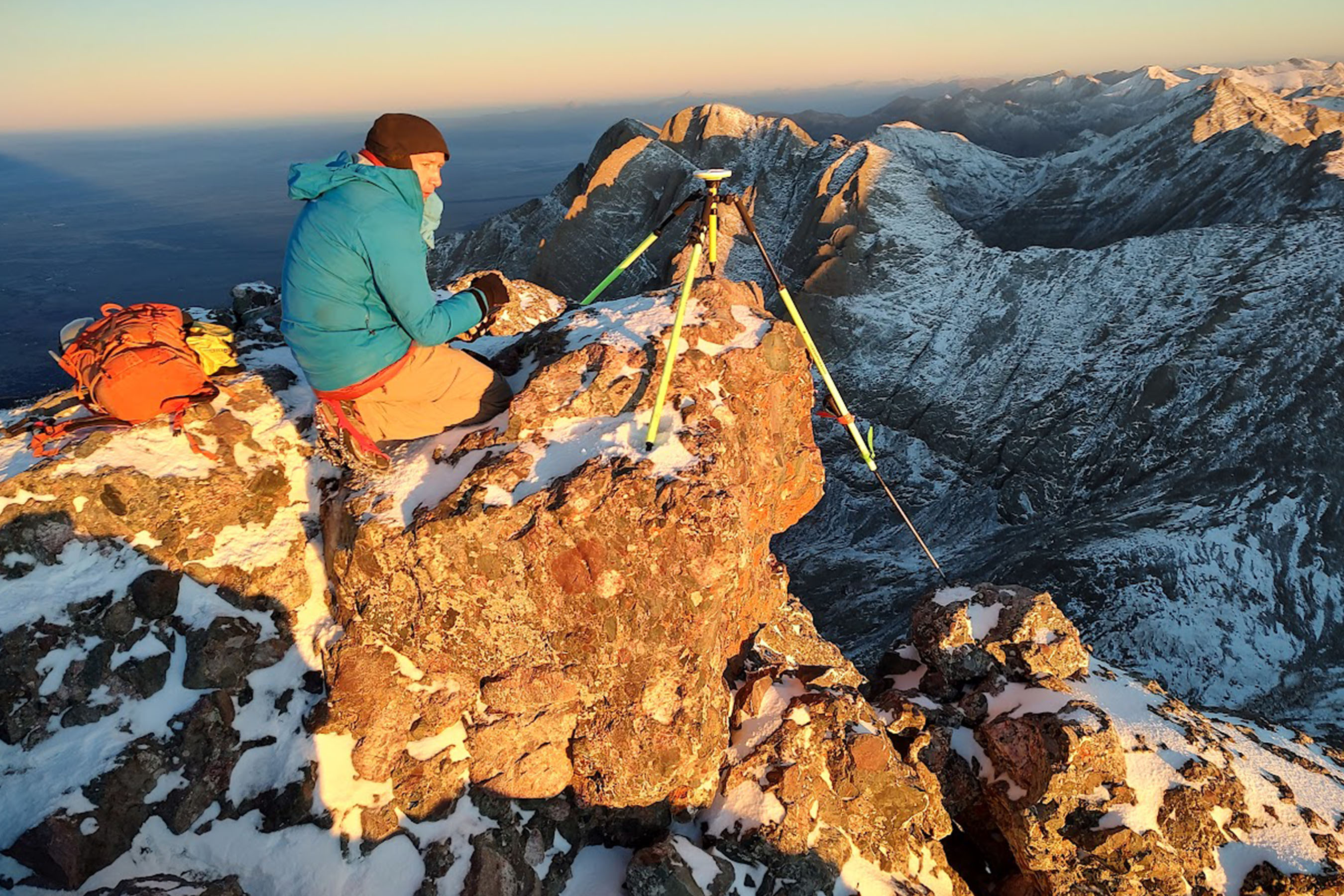
The October 2025 Survey wasn't a quick "point and click" operation. To eliminate errors caused by atmospheric distortion—the way the ionosphere and troposphere can "bend" satellite signals—the team implemented a "Double-Peak" strategy. This involved placing receivers on both East Crestone and Crestone Peak at the exact same time.
By logging simultaneous data for 135 minutes (2 hours and 15 minutes), the surveyors could compare the two points in real-time. This method cancels out common environmental variables, ensuring that the 3.6-inch difference isn't a fluke of satellite timing, but a geographical reality.
Ranked vs. Unranked: Understanding the 300-Foot Prominence Rule
To the casual observer, it might seem logical to simply add East Crestone to the list and keep Crestone Peak as well. However, Colorado’s 14er list is governed by the "300-foot prominence rule." This rule, widely accepted by organizations like the Colorado Mountain Club and the USGS for ranking purposes, states that a peak must rise at least 300 feet above the highest saddle connecting it to a higher neighbor to be considered an independent mountain.
- The Saddle Depth: The ridge connecting East Crestone and Crestone Peak is incredibly shallow, with a saddle depth of approximately 50 feet.
- The Consequence: Because they are so close in elevation and separated by so little vertical drop, they are considered parts of the same mountain.
- The Winner: Only the highest point on that mass gets the "ranked" status. Since East Crestone is the taller of the two, it takes the rank, and Crestone Peak becomes "unranked."
This administrative demotion doesn't make Crestone Peak any less dangerous or beautiful, but it does change the "Official 58" checklist. It is a stark reminder that in the world of high-altitude surveying, prominence is the gatekeeper of status.
East Crestone vs. Crestone Peak: The Comparison
The precision required to distinguish these two peaks is staggering. At an elevation of nearly 14,300 feet, measuring a difference roughly the length of a smartphone requires meticulous setup and absolute stillness.
| Feature | Crestone Peak (Traditional) | East Crestone (2025 Data) |
|---|---|---|
| Elevation (ft) | 14,299.1 | 14,299.4 |
| Difference | -3.6 inches | +3.6 inches |
| Status | Unranked (Sub-peak) | Ranked Summit |
| Coordinates | 37.9669° N, 105.5851° W | 37.9672° N, 105.5839° W |
| Survey Method | dGNSS (Simultaneous) | dGNSS (Simultaneous) |
As shown in the data, the margin of error was minimized through extended dwell times. When we talk about "sub-inch accuracy" at these heights, we are looking at the pinnacle of modern geodetic science.
What This Means for Peakbaggers and the 'Official' List
If you are one of the thousands of "peakbaggers" who have already finished the 14ers, you might be feeling a sense of dread. Do you have to go back?
Technically, the "Official List" of 58 peaks—which includes five peaks that don't meet the 300-foot rule but are included for historical reasons (North Maroon, El Diente, etc.)—is maintained by community consensus and major guidebooks. However, serious purists often follow the "Ranked" list.
Expert Analysis: "The 14er list has always been a living document," says one veteran climber. "From the discovery of Mount Blue Sky's new elevation to the debates over the height of Sunlight Spire, these 2025 findings are just the latest chapter. If you want your record to be bulletproof, you go to the highest point. Period."
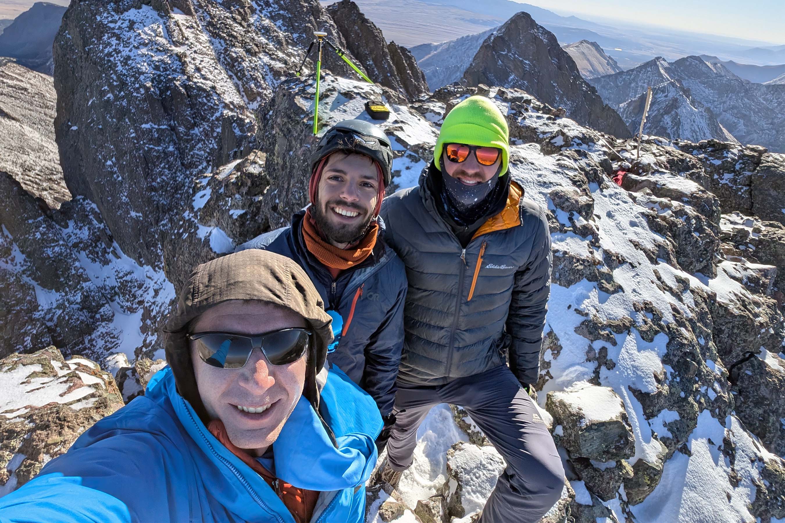
My advice for hikers: if you are planning a trip to the Crestones, summit both. The ridge between them is a scramble, but it ensures that no matter how the rankings fluctuate in the next decade, you’ve covered your bases.
Who is Eric Gilbertson and Why Does His Data Matter?
In the world of professional mountaineering and geodesy, Eric Gilbertson is a name synonymous with precision. Along with his brother, he has made a career of surveying the world’s most contested high points. His work isn't just a hobby; it’s a scientific quest to correct the legacy errors of 20th-century surveying.
His 2025 survey of the Colorado 14ers is likely to be adopted by major databases like Lists of John and 14ers.com. When data is logged for over two hours using dGNSS, it carries a weight of authority that the USGS—which often relies on older photogrammetry—simply cannot match for individual summit pins.

FAQ: Colorado 14er Ranking Updates
Is Crestone Peak still a 14er?
Yes, it is still over 14,000 feet (14,299.1 ft). However, it is no longer the "ranked" or "official" high point of the mountain group because East Crestone is 3.6 inches taller and they share the same base.
How often do mountain rankings change?
Rankings change whenever more precise technology (like dGNSS) replaces older methods (like LiDAR or barometric pressure). Major updates usually happen every 5–10 years as equipment becomes more portable for high-altitude use.
Do I need special equipment to hike East Crestone?
The route to East Crestone involves similar Class 3 terrain to the traditional Crestone Peak route. It requires standard high-altitude gear, helmet, and solid route-finding skills. The "swap" doesn't change the difficulty, only the destination's technical status.
Are you ready to update your summit log?
If you’re planning your next expedition to the Sangre de Cristos, make sure you have the most accurate coordinates and maps. High-altitude precision is the new standard for the modern explorer.